© Former Crown Manor of Ennerdale - Feudal Barony of Copeland 2020-24


The Lordship of Ennerdale, located in Cumbria, encompasses approximately 17,000 acres. This extensive area
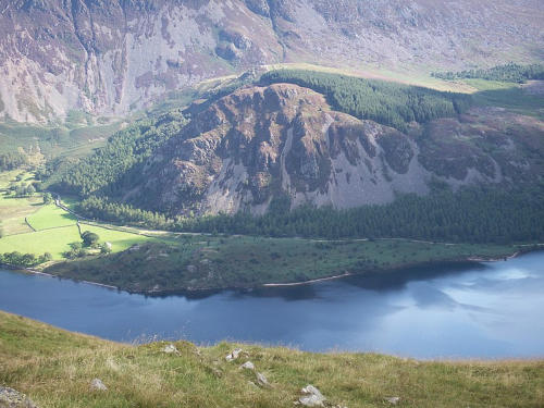
includes Ennerdale Forest, which covers about 7,500 acres, and Ennerdale Water, a glacial lake that spans roughly
1,400 acres. Additionally, the waste lands of the manor amount to around 11,000 acres This region is part of the
Lake District National Park and features a diverse landscape of mountains, rivers, forests, and historic sites, making
it one of the most scenic and historically rich areas in the UK.
In 1821, the Lord of Ennerdale was also the Queen of England which means that Ennerdale was a “Crown Manor”.
In 1822 The Earl of Lonsdale (The Lowthers) purchased of the Crown the manor of Ennerdale , with all the mines ,
quarries , etc. — for a sum of £ 2,500 . In 2019, the relative value of £2,500 from 1822 ranges up to about to
£13,940,000.00. Pounds Sterling. The Ennerdale Lordship or feudal barony was in the dominion of the Scottish
crown and English crown during different periods in history. The Lordship of Ennerdale lies in one of the wildest and
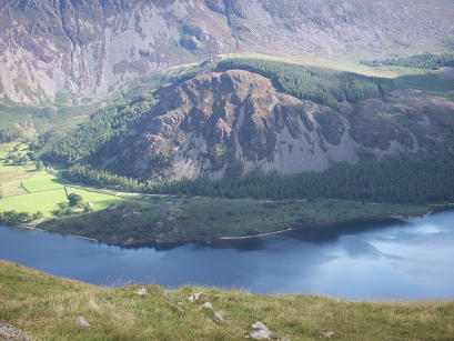
beautiful parts of the Lake District. It includes, in its 17,000 or so acres, rivers, mountains, Viking ruins, and the
glacial lake, Ennerdale Water the most western of the lakes. Ennerdale Valley lies 8 miles from the coast and is
surrounded by several fells including Great Borne (2019 ft), Great Gable (2949 ft) and Pillar Mountain (2927 ft). The
Crown Manor of Enerdale is roughly the same size as Manhatten or New York City.
Ennerdale was the last existing portion of the feudal Barony of Copeland to independently exist which was forfeited to
the Crown in 1554. Ennerdale had belongded to the family of the 9 Day Queen, Lady Jane Grey, and because the
Grey’s lost their battle for the crown with Mary, the Lordship went back to the Crown. Ennerdale or Eynerdale
remained a Crown Manor until the feudal titles and land were sold with rights to Lord Lonsdale in 1821 for £2500
pounds sterling to the noble house of Baron Whitehaven.
Ennerdale (Alnanderdale or Eynerdale) sallis ad Eyn, both the town and parish now called by the inhabitants. The
Irish named it Lough-Eanheh Lacus volucrum, of the fowls that bred there in the islands; and the river Oonh-Eanheh
and the dale Eanor or Ar-ean. The Saxons still retaining the Irish name called the bottom and valley Enerdale.
The Crown Manor of Ennerdale : A portion of the Barony of Copeland was given by Ranulf le Meschin, 3rd Earl of
Chester (1070−1129) to the priory of St.Bees, and the rest of Eynerdale which was the last independent section of the
Barony of Copeland called today Ennerdale passed successively to the families of de Harrington then the de Bonville’s
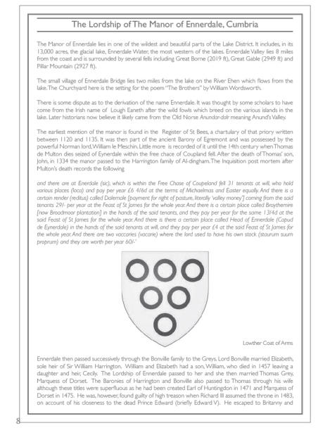
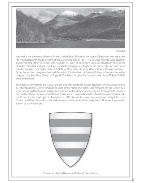
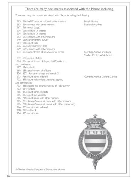
, The Duke of Suffolk and the Grey’s. This area was forfeited to the crown in 1554 by Henry Grey the father of Lady
Jane Grey. It was granted by Elizabeth I to its tenants in 1568. The complicated interaction between the Patricksons
& the Ennerdale tenants with the Crown is well documented in “Around & About Ennerdale” by Bob Orrell in 1997.
Ennerdale was now vested to the Earl of Lonsdale, having been purchased by that family in 1821. The medieval
vaccary recorded in AD 1322 is described as being at the Capud de Eynerdale (head of Ennerdale), which broadly
corresponds to the Gillerthwaite area.
The original Copeland or Egremont castle was built on a mound above the River Ehen on the site of a Danish fort
following the conquest of Cumberland in 1092 by William II of England. The present castle was built by William
Meschin, who founded the castle between 1120 and 1135. Further additions were made in the 13th century. It
eventually fell into disuse and became the ruin it is today.
Copeland Castle stands on a small hill overlooking the town. Built in the eleventh century, it exhibits all the
hallmarks of the strength of purpose associated with Norman castles. It was erected by William de Meschines, the first
baron of Copeland.
In the early years of his reign, Henry I. gave the newlyformed barony of Copeland to William de Meschines, who
changed its name to Egremont. Meschines was probably the founder of the Norman chapel there, which he gave to the
priory of St. Bees. also known as Henry Beauclerc, was King of England from 1100 to his death in 1135.
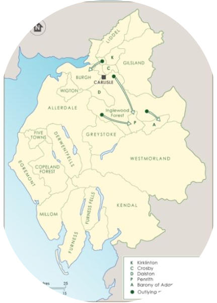
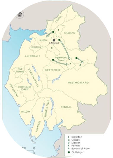
The province of Cumberland in Cumbria was parcelled out into eleven baronies, namely, Coupland or Egremont,
including the Honour of Cockermouth Castle, Allerdale, Wigton, Gilsland, Burgh, Greystoke, Liddell, Dalston, Crosby,
Kirklevington, and a nameless one given to Adam Fitz Seyn. De Meschines reserved to himself the Forest of Inglewood,
but shortly afterwards resigned his rights in the North to the Crown in exchange for the Earldom of Chester; the
Crown, when it had, about the year 1154, chased the Scots out of the North, confirmed by proper deeds all Ranulph's
grantees in their premises.
Ennerdale is one of the largest manors in the United Kingdom. The size of the waste lands of the manor of Ennerdale
in the township of Ennerdale, contain a whopping 11,000 acres of water, minerals, and potentially oil and gas. Keep
in mind, the common land is separate from the larger area Waste. Land which was neither let to tenants nor formed
part of demesne lands was known as "manorial waste"; typically, this included hedges, verges, mountains, waterfalls,
lakes etc. Common land where all members of the community had right of passage was known as "lord's waste". *
Reports from Commissioners, 1864
Manorial Waste include: Mountains and Crags: Rocky or rugged terrain, often found in hilly or mountainous regions.
Heath: Open, grassy land with low shrubs, often characterized by poor soil quality. Moor: Wet, boggy land covered
with heather, grasses, and sometimes small trees. Fen: Low-lying, marshy land with waterlogged soil. Ponds and
streams: Water features used for fishing or other purposes. Woodland: Forested areas that provided timber and other
resources. Overall, Commons is a smaller piece or the subset of Waste Areas where villagers had rights to graze
livestock, gather wood, or cut turf for fuel.
The Mountains of Ennerdale
Great Gable and its lesser companion Green Gable stand at the head of Ennerdale, with the walkers' pass of Sty Head
to their backs. This connects Borrowdale to Wasdale, giving Gable a footing in both valleys. The Borrowdale
connection is quite tenuous, but Great Gable is prominent in almost any view up the lake.
Ennerdale Pillar is a mountain in the western part of the English Lake District. Situated between the valleys of
Ennerdale to the north and Wasdale to the south, it is the highest point of the Pillar group. At 892 metres it is the
eighth-highest mountain in the Lake District.
Great Borne is customarily climbed from the Ennerdale side of the fell, with the car park beneath Bowness Knott
being the usual starting point. ... Ennerdale water is well seen from the summit, with parts of the lakes of Crummock
Water and Loweswater also visible.
Grike Fell
Crag Fell
Brown How
Boat How
See All LINK
See links of Ennerdale Valley
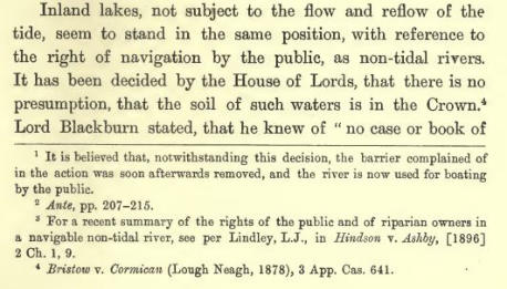
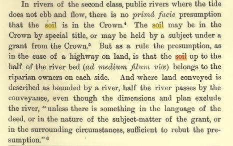
Lakes and Rivers - The Lords of Inland Lakes and Non-Tidal Rivers and Streams
About the Lord Barons of Ennerdale Copeland
The Manor of Ennerdale has now become the 9th largest "National
Nature Reserve" in England covering over 3000 hectares of landscape
comprising water, forests and mountains. https://www.gov.uk/government/news/3000-hectares-
of-spectacular-lake-district-landscape-becomes-a-new-national-nature-reserve

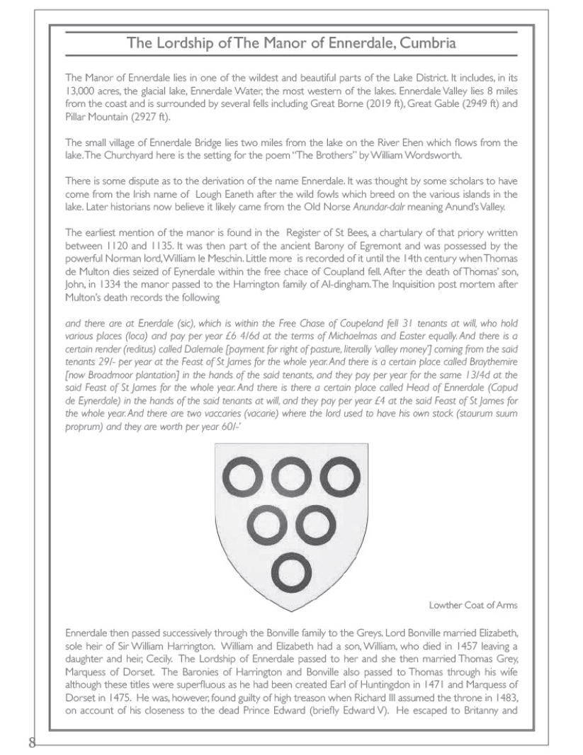
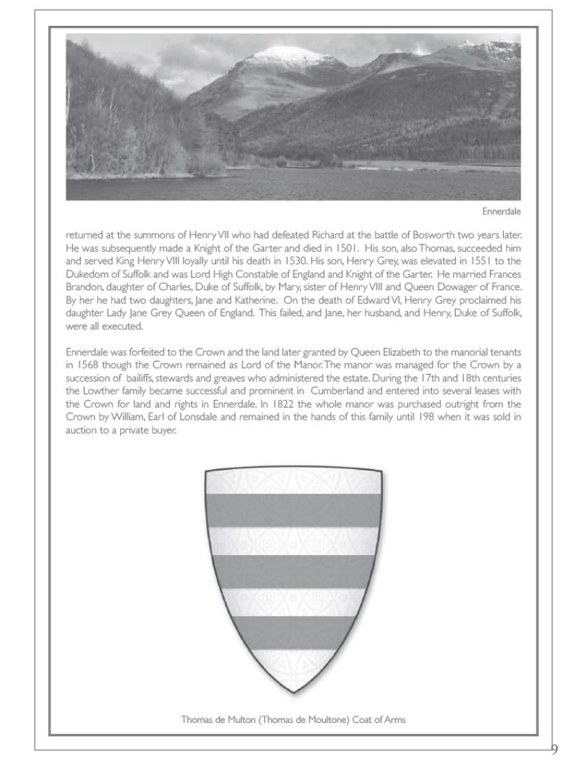
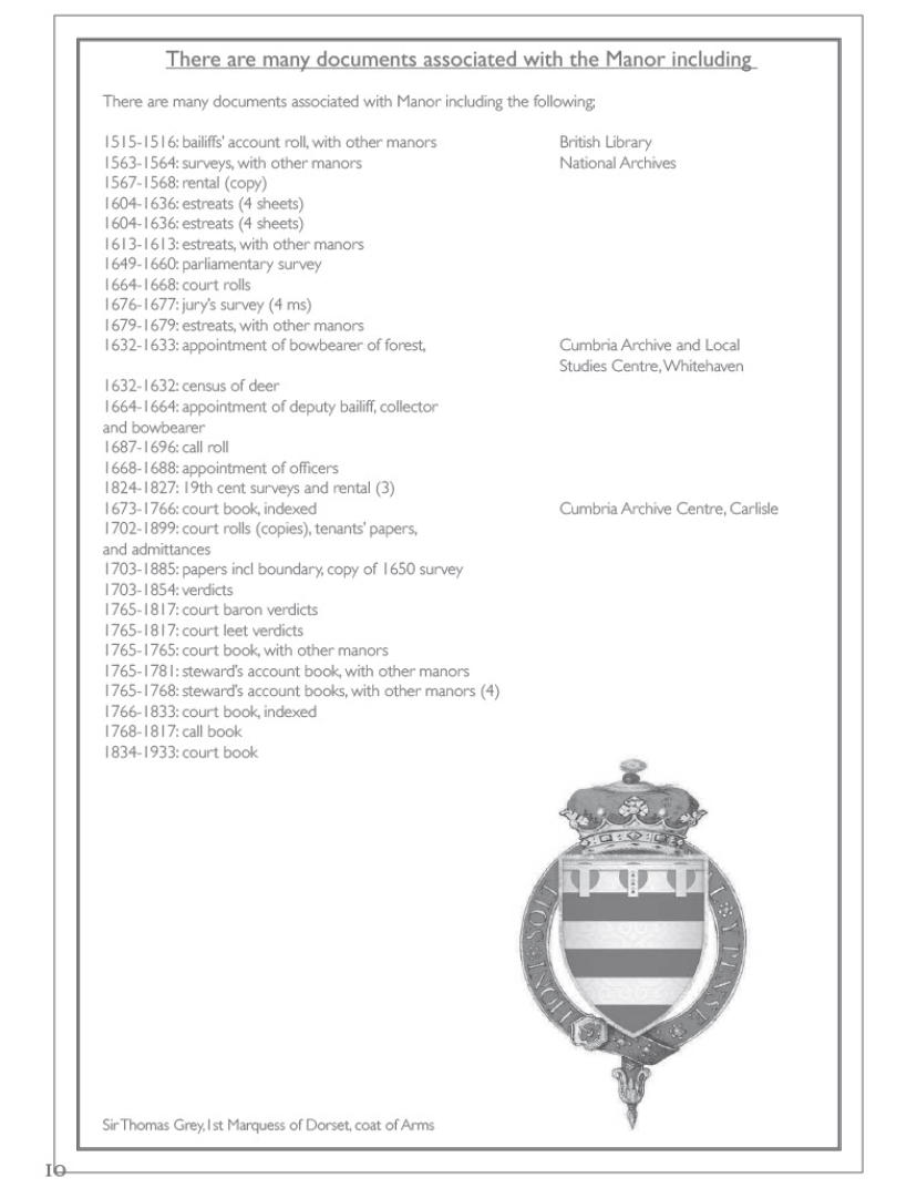
Ennerdale Bailiwick - A bailiwick was a jurisdictional division within a larger administrative or legal territory — especially in forests, liberties, or
manors. This historical designation within the Free Chase of Coupland as a “distinct bailiwick” indicates that Ennerdale held semi-autonomous status.
: The Manor and Forest of Ennerdale likely comprised about 20% of the total area of the Free Chase of Coupland Fell, making it one of the largest and
most significant divisions within that royal or manorial hunting reserve. Ennerdale as a distinct bailiwick or subdivision of the Forest of Copeland,
indicating it was an important and autonomous component. Further, the Liberty of Ennerdale had its own court leet or court baron, for legal disputes
or enforcing forest and manorial laws. Ennerdale had its own control over hunting, grazing, forestry, and fisheries in that bailiwick. Ennerdale was a
self-contained lordship since the 1300s, not merely a peripheral woodland. Ennerdale has had its own caput Head of Ennerdale (Capud de Eynerdale)
and was home to the original Braythemire or Broadmoor Plantation. A Royal Crown Manor, Ennerdale was previously owned by the Dukes of Suffolk
and King Charles. The Seigneur of Fief Blondel et L'Eperons now owns the rights to the manor of Ennerdale as part of a conveyance from the Earl
Lonsdale in "Fee Simple". Ennerdale manor includes all rights, hereditaments, and appurtenances, unless specifically reserved by Lonsdale, the
Crown, or the State. Even today, Ennerdale would still rank as one of the largest manorial titles with intact historical rights in private hands — making
it truly unique.
Today, the Lordship of the Manor of Ennerdale exists as an incorporeal hereditament, retaining ceremonial dignities and powers, rights to court leet
and manorial waste, and potential registered rights over water, hunting, and fishing under post-1925 and 2002 property law frameworks. The historic
bailiwick and liberty designations remain critical in understanding the juridical and territorial autonomy of Ennerdale during the medieval and early
modern periods.
Royal oversight as a Crown Liberty and Forest implies that Ennerdale has a superior feudal pedigree. A Crown-to-subject sale or grant, like that of
Ennerdale to Lord Lonsdale in 1822, would constitute a direct alienation of royal lands, a rarity in British history. Given the jurisdictional authority,
royal provenance, and landed liberty, the most accurate Danish, Swedish, or Viking-style feudal title for Mentz would be: Jarl of Ennerdalr,Hersir of the
Royal Forest and Liberty, or Drotten of the Bailiwick of Ennerdale. Alternatively, Chief Mentz could style himself: Goði of Ennerdalr, Lord of the Thing
and Forest Court.
George Mentz’s noble standing—encompassing his titles as Lord of the Manor, Forest, and Liberty of Ennerdale; holder of a former Royal Bailiwick
with court leet jurisdiction and autonomous legal authority; and Seigneur of the Crown-recognized Fief Blondel of Guernsey—places him in a rare
composite class of historical nobility. His position surpasses that of modern ceremonial barons and viscounts who lack judicial or territorial rights and
compares favorably to continental barons and counts who held active dominion over land and law. Functioning as a true Liberty Lord or Feudal
Palatine Lord, Mentz embodies the legal and historical status of a semi-independent noble, combining sovereign-delegated power, feudal jurisdiction,
and land-based authority once typical only of the highest-ranking medieval lords.
George Mentz’s role as holder of the Royal Bailiwick and Liberty of Ennerdale places him in a historically comparable feudal situation to that of the
Lord of Sark, particularly with respect to jurisdictional authority, territorial autonomy, and direct Crown connection.
Both titles derive from Crown-controlled territories that were formally alienated or granted with full legal and administrative rights. The Lord of Sark
was granted seigneurial authority over the entire island of Sark by Queen Elizabeth I in 1565, including judicial control, land tenure oversight, and local
governance—essentially operating as a bailiff or governor under royal license, with near-sovereign local autonomy.
Similarly, the Royal Bailiwick of Ennerdale was historically administered by a Crown-appointed bailiff and included a court leet, liberty jurisdiction, and
forest law authority. When the Crown sold this bailiwick and forest outright in 1819, it transferred a rare and powerful package of territorial, judicial,
and symbolic rights—much like those granted to the original Lord of Sark.
Thus, Mentz, as the modern legal holder of the Ennerdale Bailiwick, functions in the same historical context as the Lord of Sark: a quasi-independent
lordship with a legacy of legal autonomy, local court authority, and feudal rights once held by the Crown, making his position one of the last true
manifestations of territorial nobility within the British tradition.
Deed Citation - Reference DLons/W/8/28/12, Manor and Forest of Ennerdale, copy of 1650 manor survey including:
court order as to sheep and goods on common, 1703; copy Crown grant to Sir James Lowther, 1765; rentals, tenants
lists, evidence for Mr Wordsworth's enquiry into encroachments, 1769; replies to Land Revenue Commissioners,
1792;valuation 1820; sale of forest to Lord Lonsdale by Commissioners of HM Woods and Forests
** Legal Note: It appears that the UK government commissioners and the Crown sold the Manor and Forest of
Ennerdale outright to Earl Lonsdale. If the government also sold and granted the rights, this may be the most
outstanding set of manorial rights in all England.
